The Earth Model Column Collaboratory (EMC2)#
To faciliate direct observational-model evaluations, we will utilize the EMC2, which is an open-source ground- and satellite-based lidar and radar instrument simulator and subcolumn generator. While it specifically targets large-scale model outputs (e.g., climate models), EMC2 is also applicable to high-resolution model output (e.g., LES). More information about EMC2 may be found in Silber et al., 2022.
An example application of EMC2 using LES outputs from the COMBLE-MIP case to simulate the Ka-band ARM Zenith Radar (KAZR) and micropulse lidar (MPL), which were deployed at the AMF1 site at Andenes, Norway, may be found in Fig. 2 below.
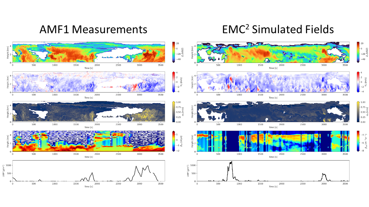
Fig. 2 Direct comparison of the (left) observed KAZR reflectivity, doppler velocity, and spectral width, as well as attenuated backscatter from the MPL and liquid water path with (right) simulated quantities applying EMC2 to the NASA DHARMA LES model.#
EMC2 can also be applied to the COMBLE-MIP LES outputs to simulate satellite-based CALIOP attenuated backscatter (Fig. 3).
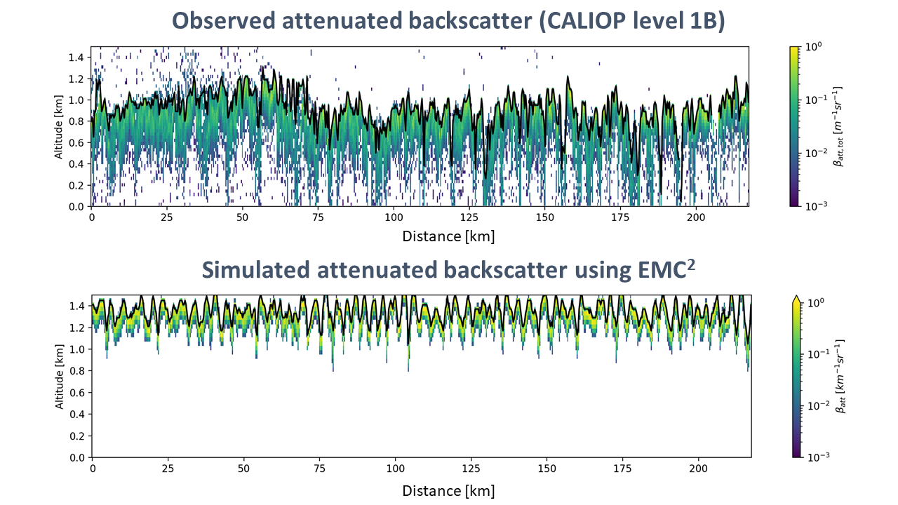
Fig. 3 Direct comparison of the (top) observed attenuated backscatter from CALIOP with (bottom) simulated attenuated backscatter applying EMC2 to the NASA DHARMA LES model.#
For the COMBLE-MIP, we will apply EMC2 to participants’ LES output fields. More details to come regarding which 3D output fields are required.